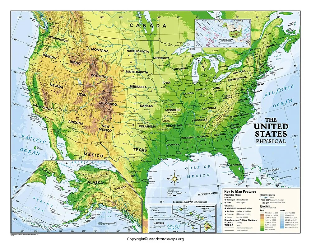
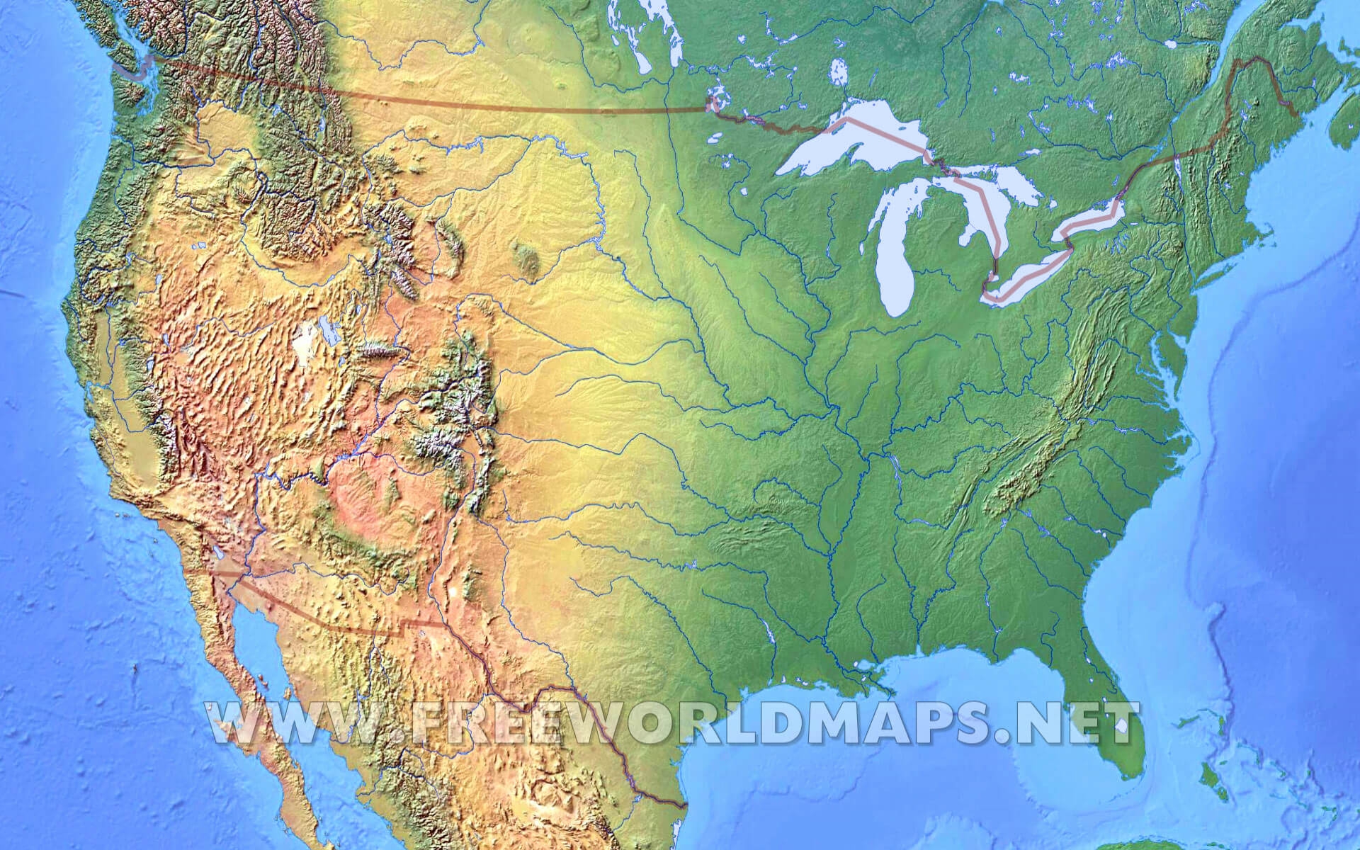
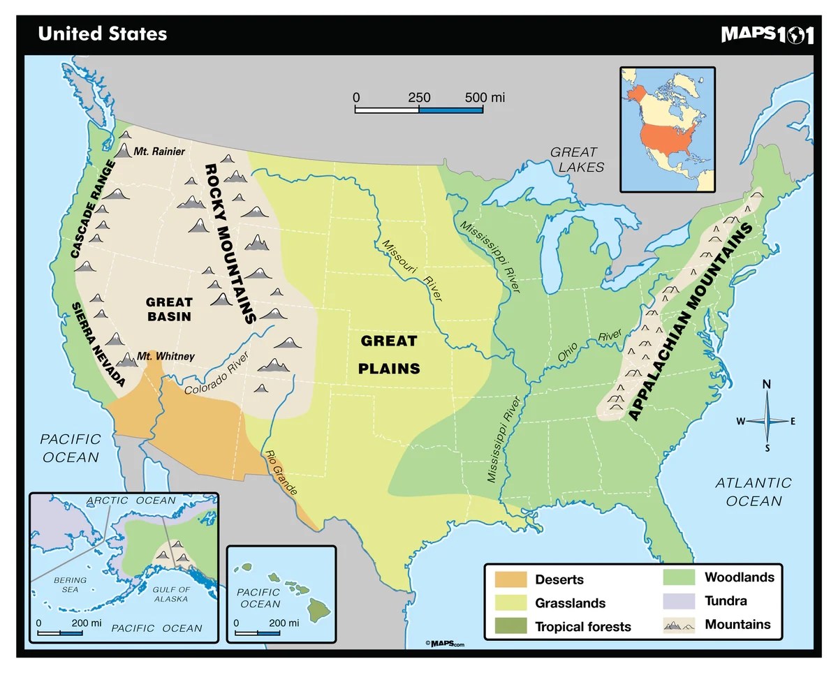
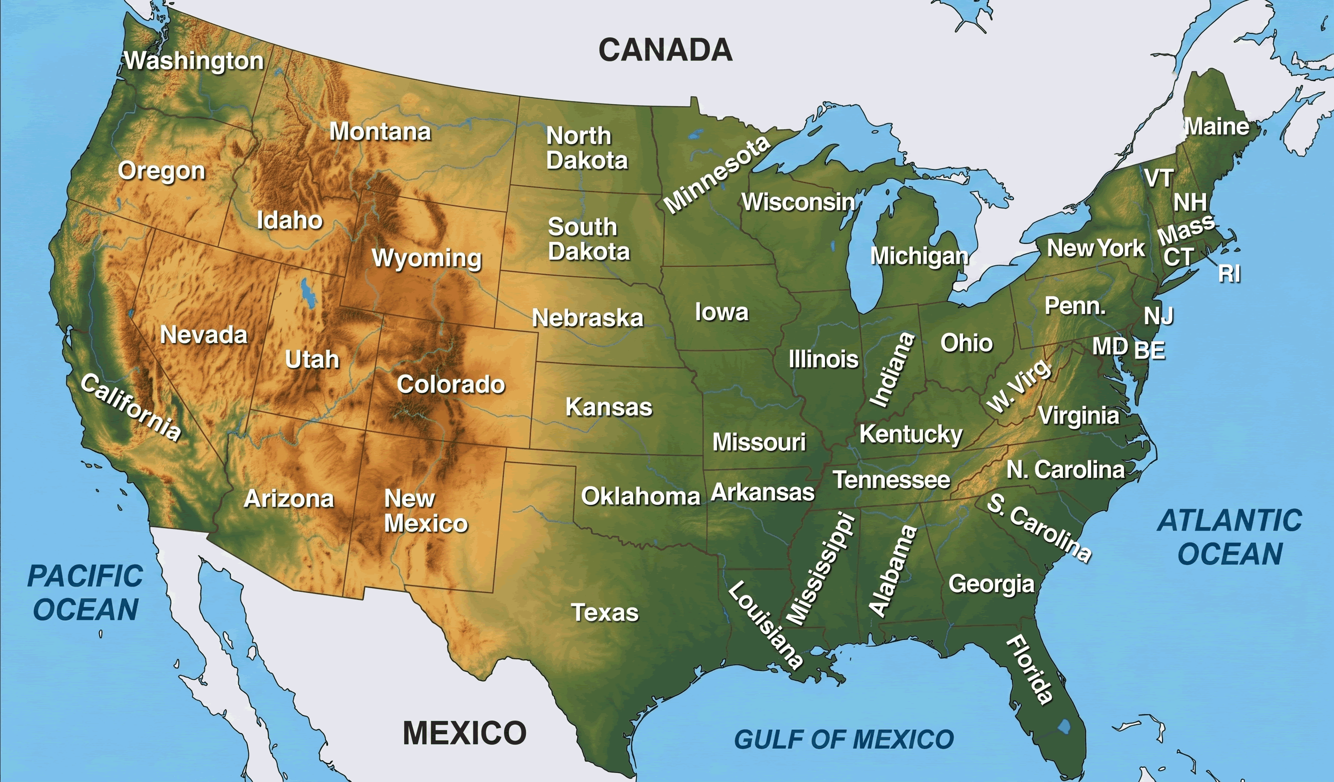
- What are the major mountain ranges on a physical map of the US?The main mountain ranges include the **Rocky Mountains** in the West the **Appalachian Mountains** in the East the **Sierra Nevada** in California and the **Cascade Range** in the Pacific Northwest. These form the prominent elevated regions across the country.
- Where can I locate the Great Plains on a US physical features map?The **Great Plains** stretch across the central United States east of the Rocky Mountains and west of the Mississippi River. They are characterized by vast flat grasslands and fertile soil visible as a large relatively flat area on physical maps.
- What are the significant river systems highlighted on a map of US physical features?The **Mississippi River** system is the largest draining much of the central US. Other vital rivers include the **Missouri River** **Colorado River** **Columbia River** and **Rio Grande** all crucial for hydrology and shaping the landscape.
- How do the Great Lakes appear on a physical map of the US?The **Great Lakes** are a series of large freshwater lakes located in the upper mid-eastern region of North America straddling the US-Canada border. They are clearly visible as massive water bodies Superior Michigan Huron Erie and Ontario.
- What desert regions are prominent on a physical map of the US?Prominent desert regions include the **Mojave Desert** California Nevada Arizona the **Sonoran Desert** Arizona California the **Chihuahuan Desert** Texas New Mexico and the **Great Basin Desert** Nevada Utah Oregon Idaho. They appear as arid often brown or light-colored areas.
- Where are the major coastal plains located on a US physical map?The **Atlantic Coastal Plain** runs along the eastern seaboard from New England down to Florida and the **Gulf Coastal Plain** extends along the Gulf of Mexico from Florida to Texas. These are flat low-lying areas adjacent to the ocean.
- Can I see volcanic features on a map of US physical features?Yes volcanic features are visible particularly in the western US. The **Cascade Range** contains numerous volcanoes e.g. Mount St. Helens Mount Hood. **Yellowstone National Park** also sits atop a supervolcano and its caldera can be discerned on detailed physical maps.
Uncover the stunning landscapes of the United States with our comprehensive guide to its physical features map. From the towering peaks of the Rocky Mountains to the vast expanse of the Great Plains and the intricate network of the Mississippi River, this guide helps Gen Z and Millennials explore Americas diverse geography. Discover key regions like the Appalachian Mountains, the Great Lakes, the Pacific Coast Ranges, and the arid deserts of the Southwest. Optimized for mobile discovery, our content focuses on making complex geographical data easily accessible and engaging. Perfect for students travelers or anyone curious about the natural wonders shaping the US we provide practical insights and navigation tips for your next adventure. Learn how digital maps bring these features to life offering interactive views and detailed information right at your fingertips. Stay ahead in 2026 by understanding the dynamic geological forces that continue to sculpt this magnificent nation.
- What are the primary mountain ranges in the US? - The primary mountain ranges visible on a map of the US physical features are the Rocky Mountains in the west the Appalachian Mountains in the east and the Sierra Nevada and Cascade Range on the Pacific coast. These formations define much of the continental topography and climate patterns across the country.
- Where are the Great Plains located on a US physical map? - The Great Plains are situated in the central United States extending eastward from the Rocky Mountains towards the Mississippi River. This vast largely flat expanse is known for its fertile soil and grasslands a key agricultural region depicted prominently on physical feature maps.
- Which major rivers are depicted on a map of US physical features? - Key rivers highlighted include the Mississippi River the Missouri River the Colorado River the Columbia River and the Rio Grande. These extensive river systems are crucial for drainage transportation and natural resource management across various US regions.
- How can I identify the Great Lakes on a US physical features map? - The Great LakesSuperior Michigan Huron Erie and Ontarioare prominently displayed in the upper mid-eastern US bordering Canada. They are massive freshwater bodies easily recognizable features that significantly impact the regions climate and economy.
- What are the main desert regions on a US physical map? - Major desert regions include the Mojave Desert in the Southwest the Sonoran Desert spanning parts of Arizona and California the Chihuahuan Desert in Texas and New Mexico and the Great Basin Desert covering much of Nevada and Utah. These arid zones are distinct topographical features.
- Where can I find the coastal plains on a map of US physical features? - The Atlantic Coastal Plain stretches along the eastern seaboard from New England to Florida while the Gulf Coastal Plain runs from Florida along the Gulf of Mexico to Texas. These are low-lying flat areas crucial for coastal ecosystems and human settlements.
- Are volcanic features visible on a US physical map and where? - Yes volcanic features are visible predominantly in the western US. The Cascade Range hosts prominent volcanoes like Mount St. Helens and Mount Hood. Additionally the Yellowstone caldera a supervolcano is discernible as a distinct geological area on detailed physical maps.
Ever wondered about the stunning natural tapestry of the United States? Understanding the map of the US physical features unlocks a new appreciation for the diverse landscapes that define America. From majestic mountain ranges to sprawling plains and intricate river systems exploring these geographical wonders is now easier than ever especially with the power of modern digital maps.
This guide is your quick mobile-friendly introduction to the physical geography of the US designed for curious minds eager to learn and explore.
Frequently Asked Questions
Where can I find the best interactive map of US physical features?
The absolute best locations directly include **Google Maps** **National Geographic** and specialized geological survey websites like the **USGS**. These platforms offer detailed zoomable views of Americas diverse terrain.
How do Local Maps apps help explore US physical features?
Pull up your preferred mobile Maps app to verify real-time insights into terrain elevation and even satellite imagery. Digital maps provide dynamic routing through regions with prominent features and detailed geographical data to enhance your virtual exploration.
What are the most iconic physical features to explore in the US?
To truly grasp the US physical features start with these:
- Grand Canyon Arizona
- Yellowstone National Park Wyoming
- Mount Rushmore South Dakota
- Niagara Falls New York
Quick Local Guide: Explore America's Natural Wonders
- Rocky Mountains Western US
- Appalachian Mountains Eastern US
- Mississippi River Central US
- Great Lakes North Central US
- Grand Canyon Arizona Utah
- Mojave Desert California Nevada Arizona
Major mountain ranges Great Plains Mississippi River Great Lakes Pacific Coast Appalachian Mountains Deserts Coastlines Plateaus Valleys Volcanoes Canyons


Exploring The USA A Journey Map Decoding Labeled Physical Geography Of United States Printable Locations Printables Templates Free US06PHY Features Academia Us Mural Lg 35899 Classic Mapping A2 US2 Wall Black Frame.


Physical Map Of The United States GIS Geography US What Defines Features Usa Wall Mapsunited Detailed N O W Blank World Maps Free PDF Printables Printablee 184210 Unveiling America A Journey Large.


Map Of United States With Physical Features Detroit Chinatown Usa Dara Detailed The Vidiani Topography And AC UF894 1000 QL80 Unveiling America A Guide To Labeled 191TOPO.


Free Printable Maps Of The United States Map Physical Us Rivers Usa What Defines Features Detailed High Resolution Wall Topography.


Unveiling America A Physical Map Journey High Detailed United States Of 2pgd933 Features Usa Il JGO0 Us With Printable Original 3434469 The Reveals Varied Relief Including Plains Rainforests And Major Rivers 2R4FWMP.


Physical Features Of The Contiguous United States Laminated 7519AA1D 65AC 4ef8 B19F Map Usa Topography And Us Geography With Printable Primary Level Mad Maps Feature Il O88A North America High Resolution Details Flattened Satellite View Planet Earth Its Elements Furnished By Nasa 2F4JT6A.


Map Of United States With Physical Features Decoding The USA A Labeled Journey 340 Stock Photos Pictures Royalty America Us.